Interesting History of a Former Indian Trail in Southwest Virginia
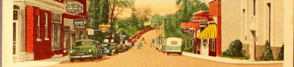
The road familiarly known as “The Old Rock Road” is the oldest in southwest Virginia. It is closely associated with pioneer days, and hence full of historic interest.
Through the passing years and changes, it has had many names; First it was an Indian trail, used by many different tribes.
As white settlers from the East came into Southwest Virginia, Tennessee and Kentucky, many followed this old trail, and it was known as “The Wilderness Road.” Later, it was the main thoroughfare for carrying on trade with the eastern markets, and was often called “The Baltimore Road.” It had been used by the brave, hardy pioneers nearly a century before it was macadamized. After this, several more names were added: “The Great Road,” “The Turnpike,” “The McAdam Road.” Now, after almost another century is gone, it is “The Old Rock Road.” Many use the name almost reverently, as they would speak of an old friend. What service it has rendered. How much history is connected with it. Yes, it is an old friend, and there is tender sentiment in the hearts of many descendants of the pioneer settlers who remember what “The Old Rock Road” was to their fathers.
Before the road was macadamized, in 1848, it was surveyed by two of Napoleon’s engineers, Crozet, and one other. Experts of today say it is a marvelous piece of engineering.
It is the most direct route from Lynchburg and Roanoke to Bristol, being eight and one-half miles shorter than the Lee Highway. All of the old road is now a part of the highway system, except about sixteen and one-half miles in Pulaski and Montgomery counties, between McAdam and the point where the old road connects with the Lee Highway, about four and one-half miles East of Ingles Ferry on New River.
Let us briefly review some of the history connected with this part of “The Old Rock Road.”
Years before Governor Spottswood and his Knights of the Horseshoe had their first view of the great Shenandoah Valley, exploring parties had crossed the mountains into New River Valley. Coloney Woods, accompanied by John A. Buchanan and others, in 1654, named this beautiful mountain stream Woods River, when or how its name was changed, is a matter of dispute. Major Hotchkiss, of Staunton, is authority of saying that a man named New kept a ferry at or near where Ingles Ferry, now is operated, and that the river was named for him.
The first white man, John Salling, who ever crossed New River, was carried captive by Indians over this trail to a point on the James River in 1730.
The Drapers Meadow Massacre, in 1755, the capture of Mary Draper Ingles, by a band of Shawnee Indians who carried her into Ohio, her escape and miraculous return, on foot, through a wilderness, are familiar history. In this same year a settlement was made where the old trail crossed the New River, and was known as the Ingles Ferry Settlement. Here William Ingles built a fort and a cabin, and with his wife, Mary Draper Ingles, restored to him, established a permanent home. The site of the old fort and cabin may be seen from the “Old Rock Road,” on the east side of the ferry.
We can scarcely conceive of the amount of travel there was over this road in pioneer days, before there were any railroads. Thousands of cattle and hogs were driven this way to Eastern markets. Records show the receipts at Ingles Ferry, amounted to one thousand dollars per month. Traffic became so heavy, that Thomas Ingles, who owned the ferry, built a covered bridge across the river, which was completed in 1842. The state bought this bridge from Mr. Ingles five years later, and soon after began the work of macadamizing the road.
All merchandise for Southwest Virginia and Kentucky was brought up the James River by canal boat, to Buchanan, where it was loaded in wagons and hauled over the “Old Rock Road” which started at that point and ended at Seven Mile Ford, where it was overtaken by railroad, and macadamizing stopped.
On the Pulaski side of Ingles Ferry was a tavern, which was very popular with travelers. George Washington, George Rogers Clark, Andrew Jackson and many other note men entertained there. It was unusual to have as many as 36 horse wagons stop for the night. A part of the old building still stands, which can be seen today by the tourist who passes over this route.
The bridge was burned during the Civil War and has never been re-built. The abutments still stand, as a reminder of its glorious past. The road also passes through the picturesque old village of Newbern the county seat of Pulaski county, from its beginning until 1893 when the old courthouse, with many valuable records, was burned. Newbern was a thriving town, and the shopping center for miles around, in pioneer days.
Virginia is justly proud of her historic wealth. The tourist does not have to travel far within her borders until he may stand at some shrine that thrills his soul with varied emotions, as he is carried back from the days that are, to the days that were.
Now that the time has come, when sense, sentiment, saving, satisfaction and safety argue in its favor, we trust to the wisdom of our commissioners to again put this part of the “Old Rock Road” on the map, as one of Virginia’s highways.
Montgomery News, Volume 4, Number 1, January 5, 1928, page 1 and 4
 Occasionally I run across a reference to an occupation that I am not familiar with. The obituary of George W. Lovern in the Montgomery News (Montgomery County, Virginia) in 1928 lists George’s occupation as wreck car master. After checking out several sites on historic occupations and railroad occupations, I had no luck finding out more about this occupation. However, I finally found the answer from Kenneth Miller of the Norfolk and Western Historical Society. He explained the term as follows: